On the morning of 26 August 2026 a Himalayan glacier snout collapsed north of Langtang Lirung. Ice, rock and till ran the Lhende Khola (Donglin Tsangpo), hit Gyirong Port and Rasuwagadhi (also written 热索桥 / 热索瓦加迪), then the Bhote Koshi and Trishuli through Timure, Syabrubesi, Betrawati and Devighat.
Gyirong Port and Rasuwagadhi, 26 August 2026: a public before/after map
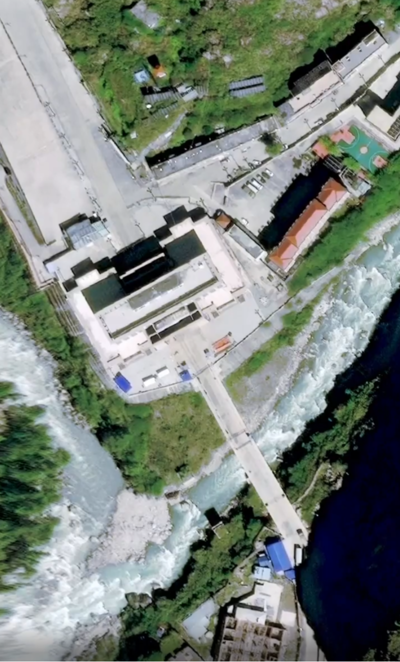
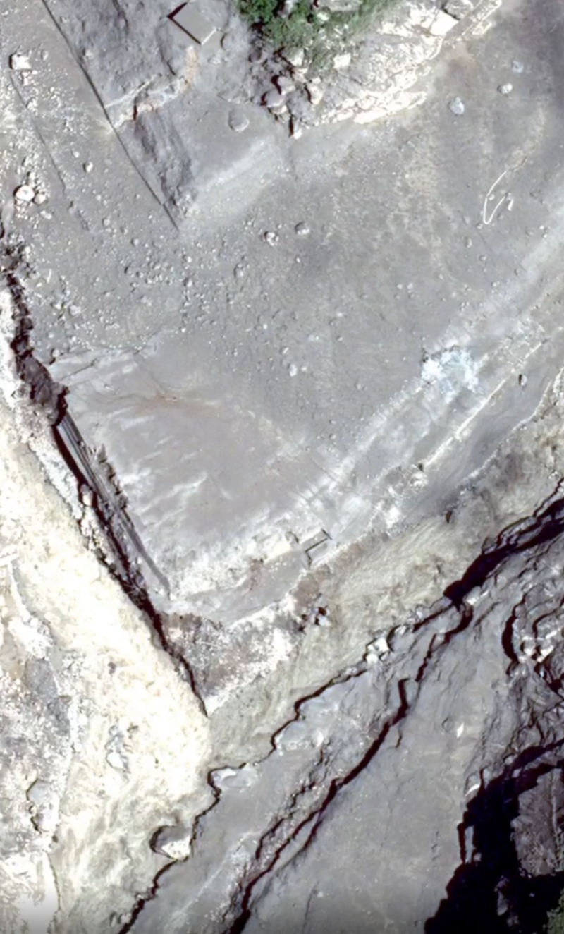
This was a landslide signal, not a tectonic earthquake
The U.S. Geological Survey revised event us7000tbwb to an M5.2 landslide at (08:37 Nepal Time, 10:52 China Standard Time). Depth 0.0 km. Early notices called it M4.4. USGS Key Points issued at 18:44 UTC that day state that long-period waves, nearby stations and satellite images show the energy came from a glacial collapse and debris flow: no tectonic earthquake occurred.
A second landslide signal, us7000tc90 about M4.2, was recorded at . Its ground relationship to the first collapse was unpublished as of 28 August 2026. Reuters, citing GFZ, put the Gyirong CCTV strike about seven minutes after the seismic origin, which matches travel time down the valley.
Three coordinates that must not be merged
- Ice-tongue snout (Hidenori Watanave, University of Tokyo, PlanetScope + Landsat): 28.2877°N, 85.52723°E.
- USGS us7000tbwb (seismic / satellite location): 28.271°N, 85.515°E, on the north face of Langtang Lirung, not the valley floor.
- Gyirong Port CCTV (Reuters visual verification): 28.28032°N, 85.37761°E. The Friendship Bridge / Rasuwagadhi temporary span sat near 28.2787°N, 85.3781°E and was destroyed on the 26th. Do not confuse the port with Gyirong town about 15 km north.
This site keeps each label on its own source. The red line on the 3D map follows OpenStreetMap waterway centrelines: Chhochen Khola → Guobaxiaqu → Donglin Zangbo (Lhende) → Bhotekoshi → Trishuli. It does not climb the USGS pin, Langtang Lirung summit, Dhunche town (about 810 m above the same-latitude channel), the Tupche hillside, or the Galchhi gaunpalika centroid. Flooded markets named in reporting are Timure, Syabrubesi, Haku Besi, Mailung and Betrawati.
What this copy adds besides Watanabe’s Cesium story
Hidenori Watanave published the Cesium Ion story Nepal - Tibet Border Flood 2026 at , credited to Planet Labs PBC / Landsat / Vantor. Open the original at ion.cesium.com/stories/viewer. This page is an independent reconstruction for non-commercial use. It is not an official product, mirror or review from that laboratory.
Where a reduced recreation would stop at two slides (source and border), this site:
- Audits the red line against OSM rivers and ridge tests (Dhunche, Tupche, Galchhi).
- Places sixteen corridor sites from the ice tongue through Gyirong / Rasuwagadhi to Devighat, Galchhi and Mugling.
- Drapes Vantor ~30 cm OpenAerialMap tiles (16 October 2021 pre-event; 27–28 August 2026 post-event) and PlanetScope 27 May 2026 on MapLibre terrain. At the snout the drape switches to GeoEye-1 2023 and same-day PlanetScope because Vantor post-event strips stop near 85.47°E and miss 85.52723°E.
- Keeps a filmstrip of public before/after sliders along the swept valley.
Open the map at a named place: Gyirong Port · Rasuwagadhi · Syabrubesi · glacier source. Hash-only links such as #rasuwagadhi are for the live camera; crawlers should use the HTML pages and ?site=.
Licenses, sensors, and what we do not copy
Landsat 9 is treated as public domain with USGS credit. Sentinel-2 may be redistributed with Copernicus attribution. Planet Crisis Response and Vantor Open Data are CC-BY-NC 4.0: attribution required, non-commercial only. This site does not dump those pixels as public-domain stock. Catalogues: Planet STAC on source.coop, Copernicus Browser, USGS EarthExplorer, OSM / Vantor Nepal Floods 2026, International Charter activation 1052 / ISRO Resourcesat-2A. Step-by-step catalogue notes are on the imagery page.
Monsoon cloud still covered much of the optical aftermath as of 29 August 2026. Sentinel-2 on 27 August was about 78% cloud at the source tile. Size estimates must stay labelled uncertain: Watanave’s 1 × 2 × 1.2 km envelope is a collapse outline, not ice volume; Dan Shugar’s ~0.2 km² is area; NRSC’s “two-thirds of a glacier body” is an area fraction; UNOSAT’s ~20 km² mudflow in the Rasuwa analysis box is unverified in the field.
Casualty figures are dated snapshots
Death and missing counts still move. Nepal Police at 07:00 NPT on reported 469 recovered bodies. NDRRMA’s sixth situation report on 27 August listed 389 recovered and 977 missing. BBC Japanese on 28 August cited at least 469 dead in Nepal and 910 missing, plus 3 confirmed dead and 558 missing in Tibet. Nepal and Tibet missing lists can overlap at Gyirong / Rasuwagadhi (pilgrims, drivers, border staff). This site does not add the two sides into one “final” number.
Chinese interface and 3D map: gyirong-rasuwa-flood.yilaoweather.org. Place pages: Gyirong Port, Rasuwagadhi. Methods: about. Timeline: brief.